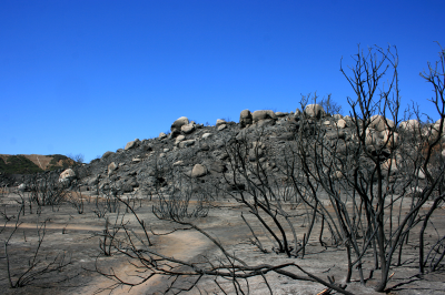
My region offers ample opportunities to observe brush fires. The chaparral and forests are dry throughout June through October. The 14-20 inches of rain per year falls mostly in the winter months.
I've been watching the recovery of the above hillside to see if it restores the vegetation it had before the fire, or whether the fire, helped by the following ten years of lower than normal rainfall, has pushed this brush into grassland. Throughout this range and along the slopes of the one I'm standing on for the picture, you can see a transition from brush to grass. The brush I'm standing among has many scorched logs, but unlike the burned area I show above, it has had either time or time during adequate rainfall to recover.
As I turn my back and continue west, I encounter a blend of brush and grass that looks ready to burn:
This brush is difficult for people to walk pass through, unless you're small enough to use the coyote trail in the middle. Here too is evidence that climate is promoting a change in ground cover. Most of the tall bushes in this picture are a species of ceonothus and most are dead. Three years ago these hills bloomed thick with their white flowers in late winter, but last winter, there was noticably less bloom on the hills.
Continuing along the trail, I reach an area that has burned within the past two weeks.
What is remarkable for me, other than the constrast between detail before a burn and the simplicity after, is how smooth the otherwise impassable ground is, that is, unless there is a rock outcrop:
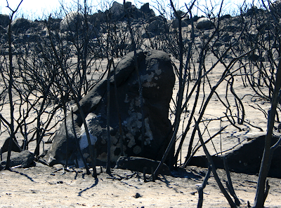
Rocky outcrops present another intrigue: fire seems thorough, and its ashes cover all fragments of vegetation and most of the rock, but here are there are rocks that appear to have been completely missed by the scorching:
If rocks had any sense of time, they'd go mad. A break from the monotany must be a fire, for then you get bouts of rapid weathering. You can see the accelorated exfoliation on many rocks, parts where the outer layers flaked off, exposing clean rock among the charred surface.
The contrast between the flaked areas and charring is remarkable, but so is the only remaining yucca plants:
The yuccas look like little white flags amongs the coals, demanding a closer look:
In its first season, the yucca grows to the size shown here. In the second, it puts up a flowering stalk. At this time of year, all the stalks are dead and laying next to their dead hosts; these yucca die after they flower and bear fruit.
I suspect that the fire started near the road. In this picture, you can see the burn extend to a ravine (not seen) and then vegetation and homes appear on the other side.
A small trail of charred ground extends from the road in this ravine, enlarges to engulf the area I passed through, and then ends at a perimeter defined by bulldozer tracks, torn bushes and broken rock, and evidence of flame retardant.
(Flame retardant on a rock)
(bull dozed sugar bushes)
(A defiant stick, all that's left from probably a manzanita)
jg


026.jpg)


No comments:
Post a Comment